


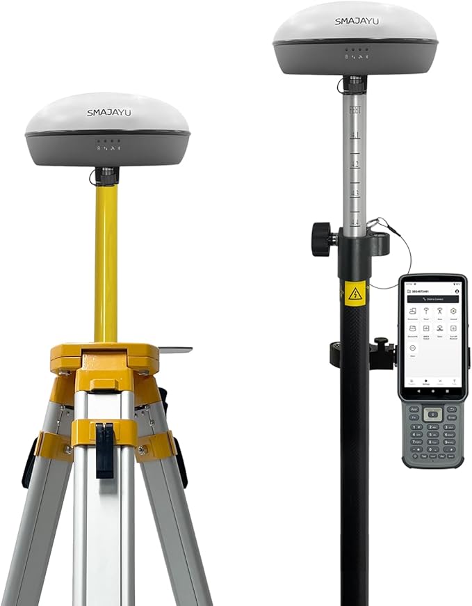


SMA20 RTK 900 MHz GPS Surveying Equipment PPK/IMU/NOAA Calibration-free, Connect with UAV/Drone,GNSS Receiver Rover Base Collector Free Permanent Software 1408 Channelsfor Construction and Engineering
(0
reviews)
Estimate Shipping Time:
3 Days
Price:
$2,591.00
/Pc
Refund:
Share:
Top Selling Products


About this item
- Advantages: ①Static &RTK base dual mode,when static surveying simultaneously work as RTK base, enable SMA20 multiple surveying mode capability and high accuracy ②NOAA certification: SMA20RTK is antenna name of NOAA registered ③PPK enabled suitable for challenge environment,forest,canyon.. in a long distance 25km ④PPP method by Galileo HAS correction ⑤Rinex logging enabled which can export rinex files directly to PC ⑥CORS network connection supported by login a CORS account on collector
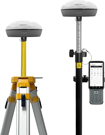
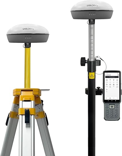
- Capability: Full-Constellation RTK GPS Land surveying equipment Rover+Base+Collector(Software activated). ①Max 25km distance between rover base by PPK; ②1cm RTK accuracy,0.25cm static accuracy ③2-8km UHF distance by RTK ④max. angle 60°tilt, 30° tilt 2.5cm accuracy (horizontal) ⑤long endurance battery,10hours for base,15hours for rover under continuous work of each battery charge ⑥2.5cm accuracy by PPK method,compatible with SMA26 static equipment; 2.5cm accuracy by CORS
- ⑦SMA20RTK GNSS Receiver offers versatile surveying modes to adapt to various project requirements and environments ⑧Data output format: RTCM3.X (input&. output), NMEA-0183 (input&. output), CMR (input), RTCM2.X (input) ⑨Multiple constellation adaptable to any country and suitable for use in various complex and challenging environments
- RTK Connection: Rover+Base:Connect Collector with GNSS receiver by BT to set rover and base at the same protocol and frequency till RTK fixed. Or Rover+CORS: login CORS account on software till RTK fixed
- Application: The SMA20 RTK GNSS receiver provides the accuracy needed for a wide range of surveying and engineering applications, including topographic surveying, geographic surveying, engineering surveying, agriculture field measurement, mine surveying, construction surveying
Loading.....